Mount Diablo Base to Summit (13 mile loop hike)
-
 Starting out on the pleasant and broad Mitchell Canyon Fire Road.
 -
 Russell amid the lush greenery in Mitchell Canyon.
 -
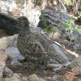
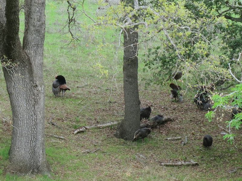 Wild turkey toms dancing for lady turkeys.
 -
 Turkey trap baited with grain.
 -
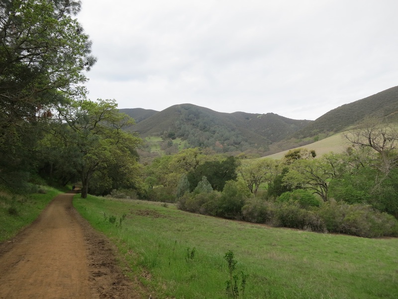 Looking south down Mitchell Canyon Fire Rd.
 -
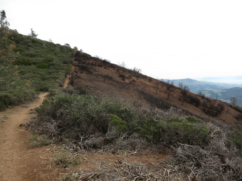
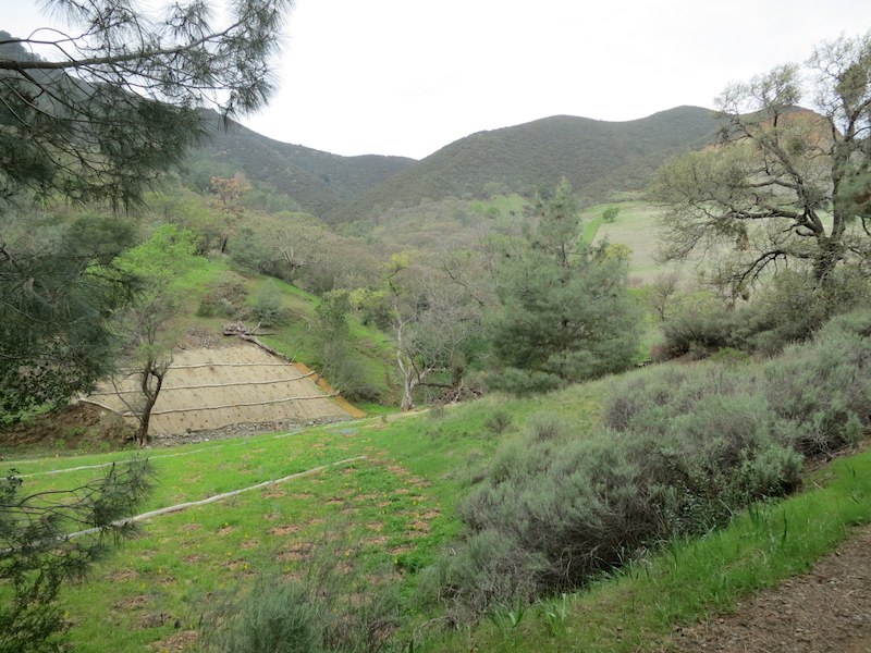 Landscape rehabilitation along Mitchell Canyon Fire Rd.
 -
 California poppies along Deer Flat Creek.
 -
 Miner's Lettuce by the side of Mitchell Canyon Rd.
 -
 Little hands! Raccoon prints headed north on Mitchell Canyon Rd.
 -
 Looking back the way we came from the ascent on Mitchell Canyon Rd.
 -
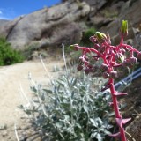
 Shooting Stars coming into bloom by the side of the fire road.
 -
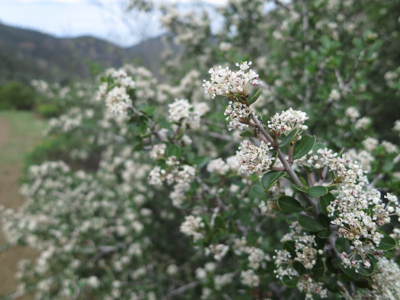
 Narrowleaf Goldenbush brightened up the muted tones of the chaparral on the climb.
 -
 Buckbrush on a north slope along the fire road.
 -
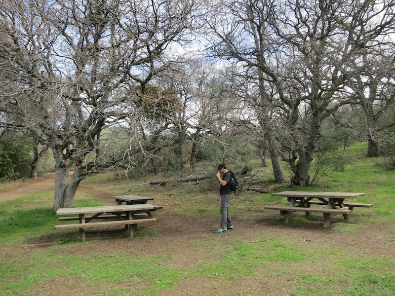 Russell reads the dedications on the picnic tables at Deer Flat.
 -
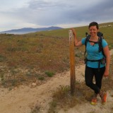
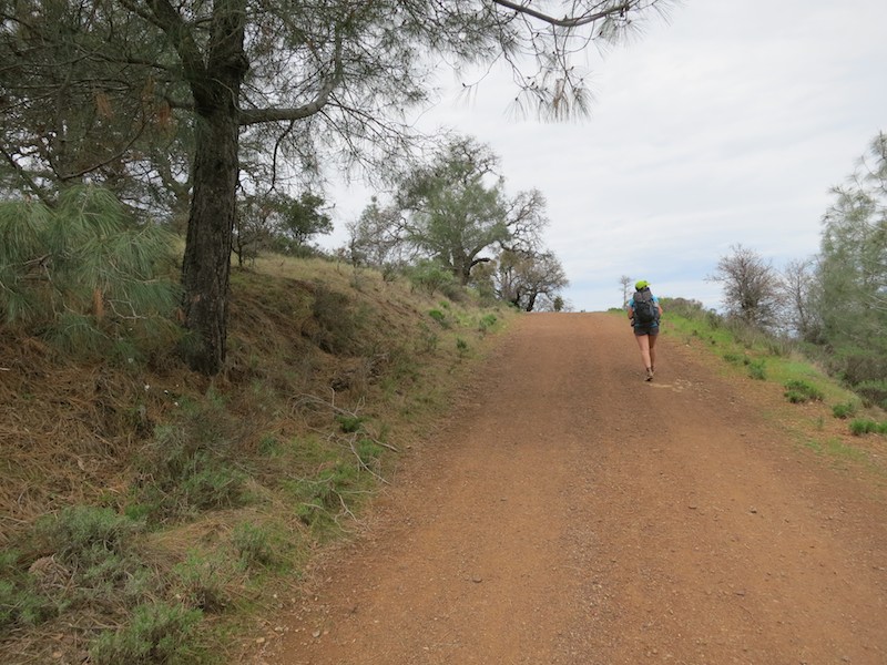 Me walking up the red dirt of Mitchell Canyon Rd.
 -
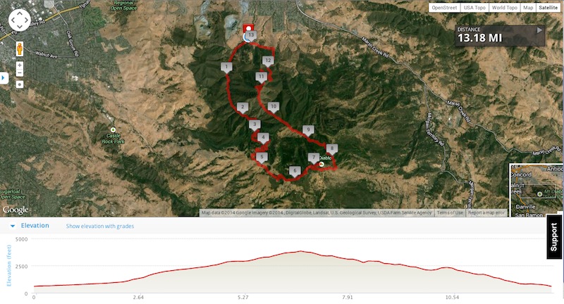 Map and elevation profile of Mount Diablo 13 mile loop hike in Mount Diablo State Park, Clayton CA.
 -
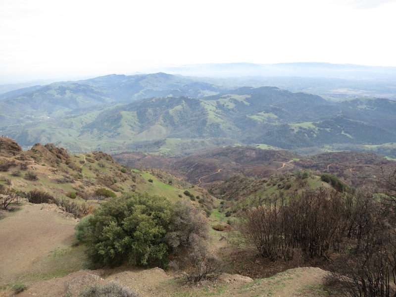
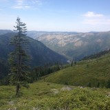
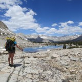
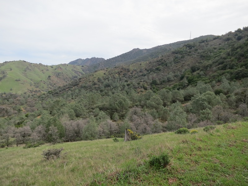 Expansive views from Mitchell Canyon Rd after Deer Flat.
 -
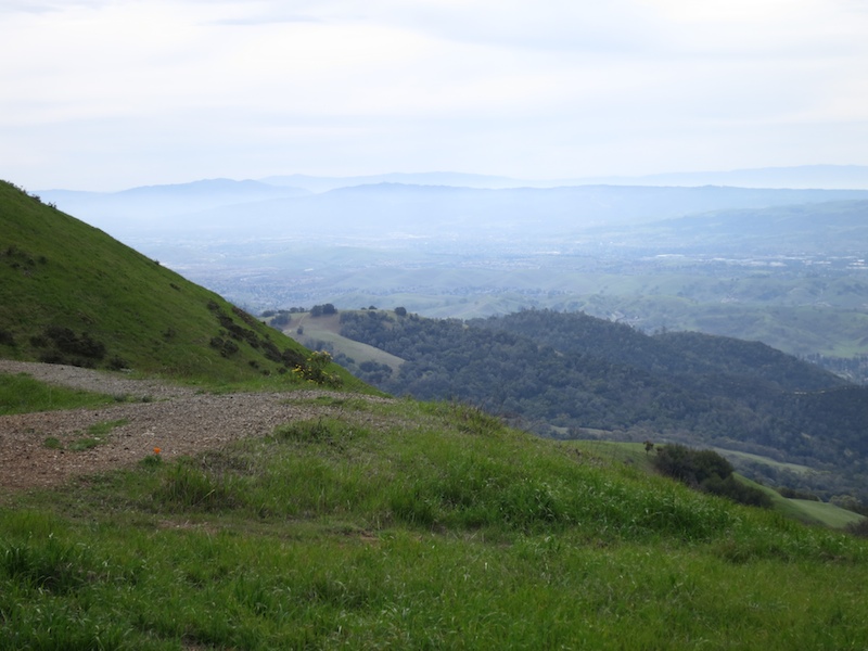 Looking westward towards the Bay and Marin County from the Deer Flat Rd junction.
 -
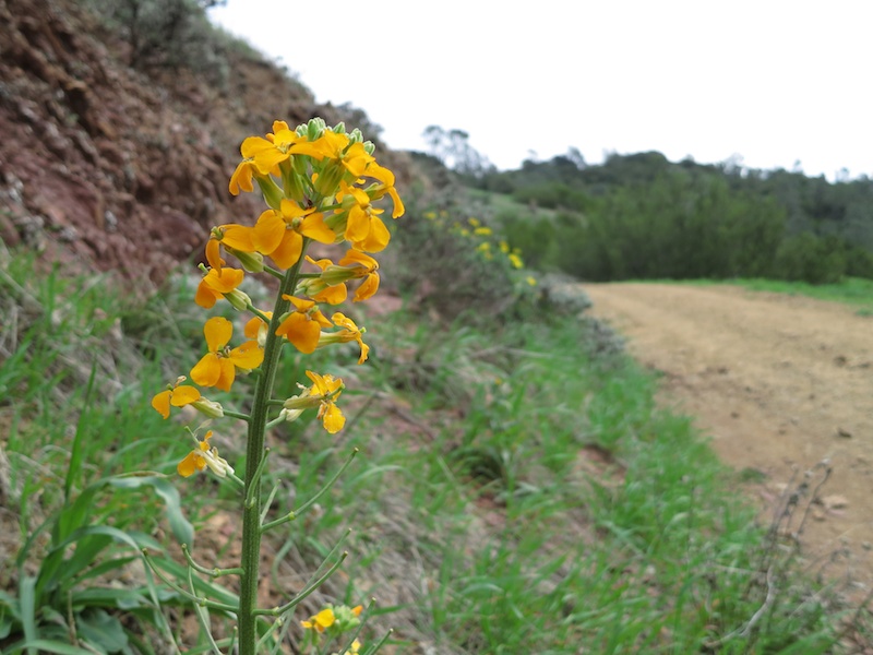 Brilliant marigold-colored wildflower by Deer Flat Rd. Some brassica sp.?
 -
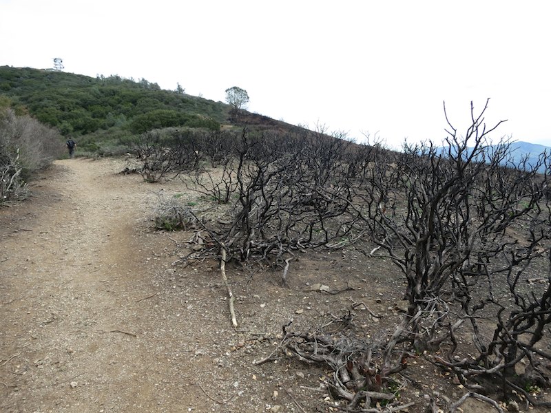 Gnarled remains of chaparral along Juniper Trail.
 -
 Juniper Trail appears to have been a fire break on this slope.
 -
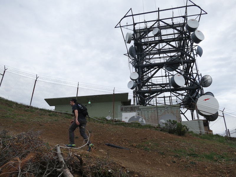 Russell and the incongruous communication tower.
 -
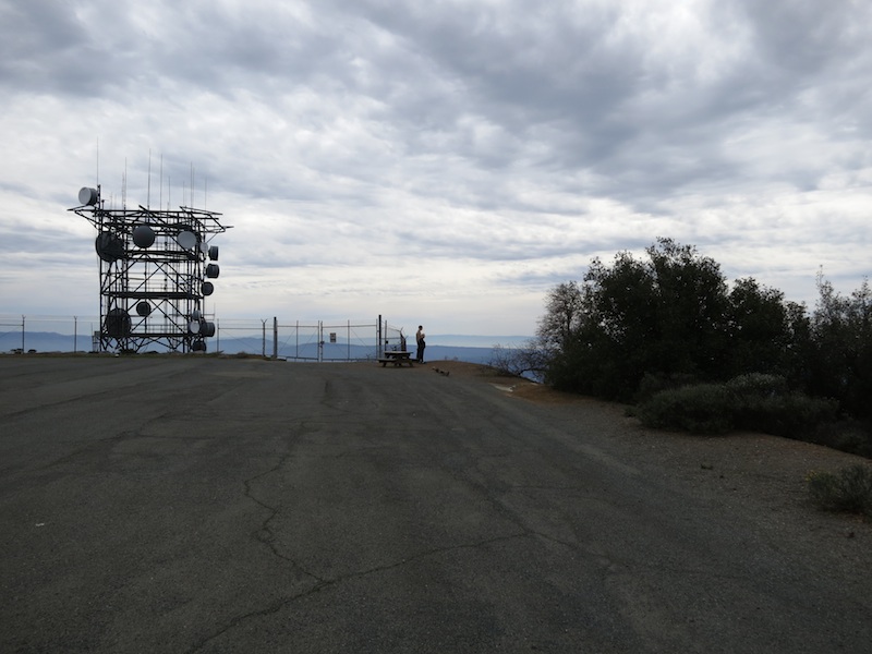 A sea of parking lot to accommodate crowds visiting the summit.
 -
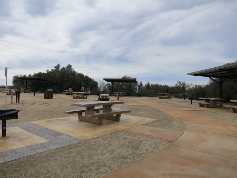 Sunset Picnic Area below the Mount Diablo Summit.
 -
 We climbed up above the communication tower quickly on our way up Summit Trail.
 -
 Crows surprised us on the Summit Trail.
 -
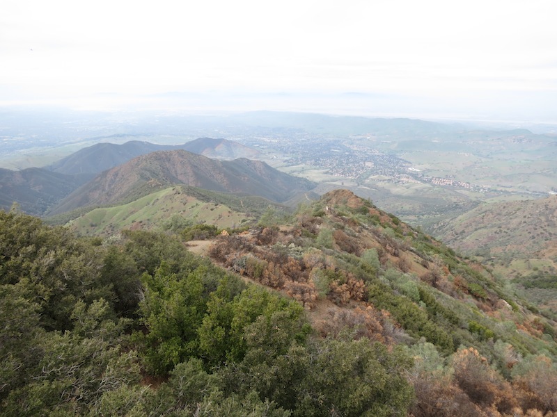
 Looking south and west from Summit Trail -- more rocks and less forest than Juniper Trail.
 -
 Follow the painted arrows, herd of big cars. Parking lot at Mount Diablo Summit.
 -
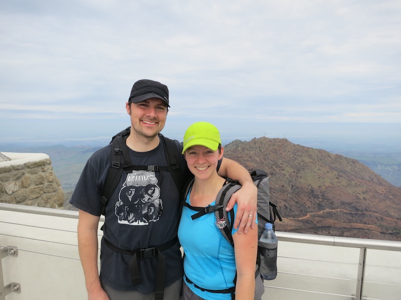 Russell & me in front of the north view from Mount Diablo Summit.
 -
 Looking north & east from the Mount Diablo Summit.
 -
 Eastward (?) view from Mount Diablo Summit.
 -
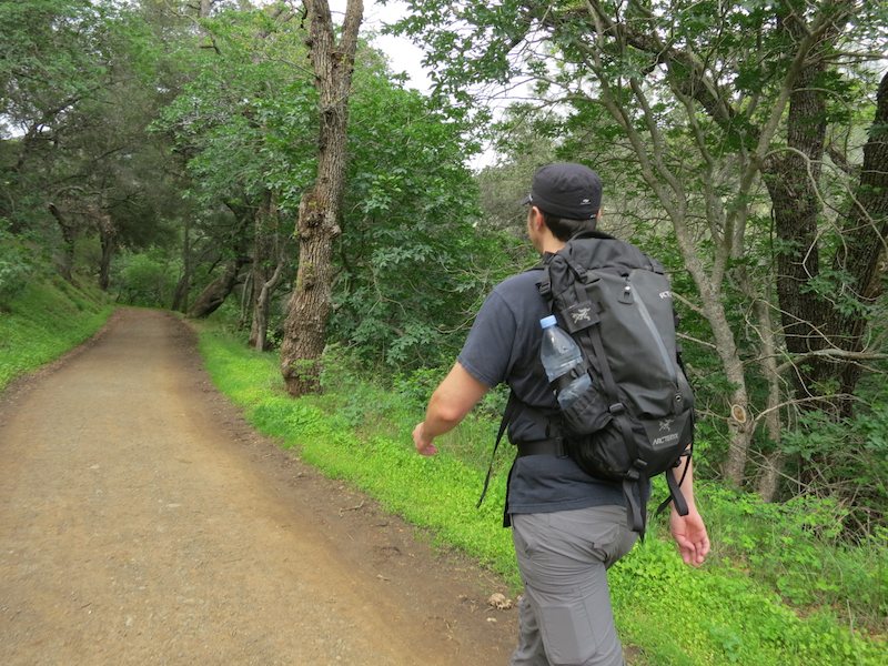
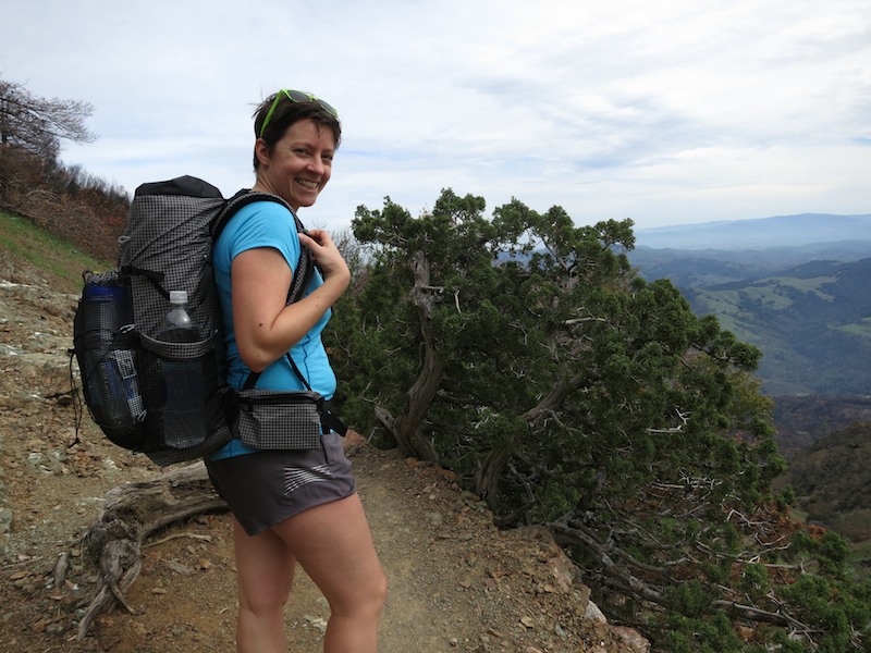
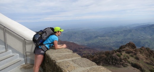
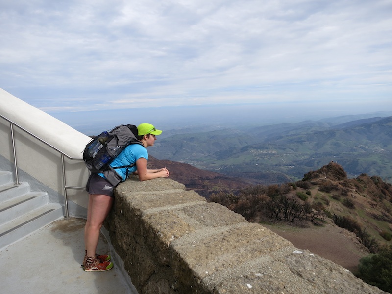 Sporting my MLD Burn pack on the stairway up to the Mount Diablo Summit.
 -
 Horse or camel? On the Summit Trail down to North Peak Trail.
 -
 The North Peak Trail from the trailhead. #morganfire04
 -
 Crowdsourcing images of the Morgan Fire recovery: station 04 at the North Peak Trailhead.
 -
 The North Peak Trail heading back north.
 -
 Russell & me on the North Peak Trail.
 -
 Risking poison oak by hiking in running shorts. What can I say, I like to live on the edge.
 -
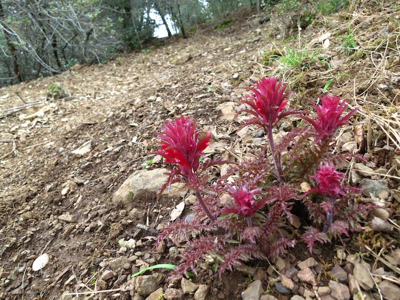 Indian Warrior in bloom with red foliage by the side of the trail.
 -
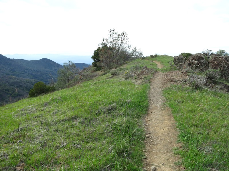 A grassy crest along the trail.
 -
 Me & Russell with the westward view from Eagle Peak.
 -
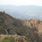
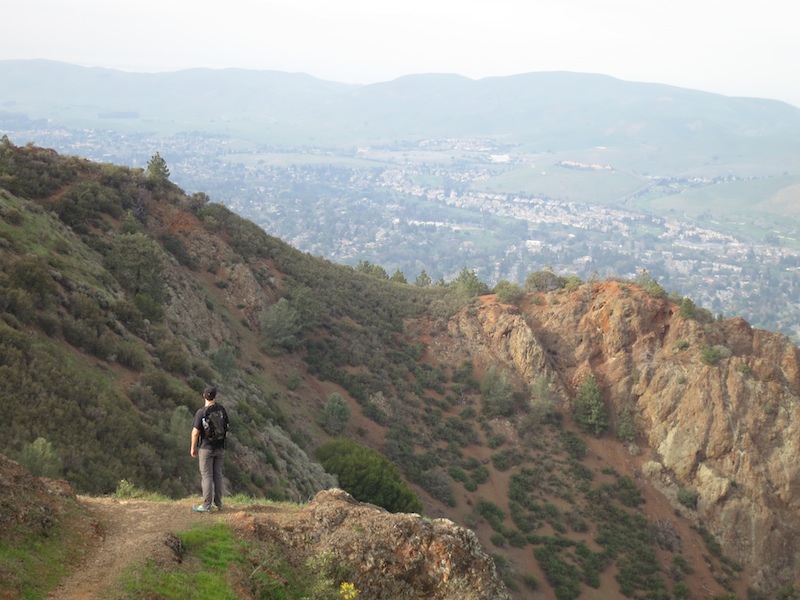 Russell looking down from Eagle Peak Trail towards Concord.
 -
 A small promontory called Twin Peaks along Eagle Peak Trail. Insert Kyle MacLachlan joke here.
 -
 Red Larkspur next to Eagle Peak Trail as we descended.
 -
 Russell at the end of Eagle Peak Trail as it joined Coulter Pine fire road.
 -
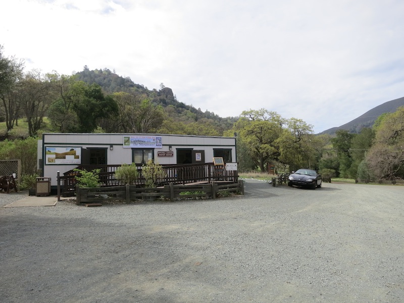 The small yet mighty visitor center at the Mitchell Canyon entrance to Mount Diablo State Park.
In a nutshell
| Mount Diablo Base to Summit | |
|---|---|
| Distance | 13.2 miles |
| Total elevation gain | 3323 ft |
| Trail type | Loop |
| Time | 6 hrs 40 min |
| Conditions | Some clouds, high of 71°F |
| Fee | $6 cash-only parking |
| Companion(s) | Russell |
[Note: This trip report describes my experience, which might be similar to or wildly different from yours. The time listed is how long it took us, not a recommendation or guideline.]
Trailhead: Mitchell Canyon Interpretive Center & Ranger Station (Clayton, CA) in Mount Diablo State Park.
Route: 3.7 miles on Mitchell Canyon Rd (fire road) (3.7 total) → 1.6 miles on Deer Flat Rd (fire road) (5.3 total) → 0.2 mile road walk across Juniper Campground (5.5 total) → 1.2 miles on Juniper Trail across Summit Rd & several big parking lots (6.7 total) → 0.2 miles on Summit Trail to the Summit Visitor Center & lookout (6.9 total) → 0.5 miles back on Summit Trail back to the first parking lot and down toward Devil’s Pulpit (7.4 total) → 0.9 miles on North Peak Trail (8.3 total) → 1.5 miles on Bald Ridge Trail (9.8 total) → 3.1 miles on Eagle Peak Trail (12.9 total) → 0.3 miles on Coulter Pine Trail Oak Road (fire road) back to the visitor center (13.2 total)
Map and elevation profile of Mount Diablo 13 mile loop hike in Mount Diablo State Park, Clayton CA.
Background
A couple years ago, before I did my first John Muir Trail section hike, I had the realization that while I thought of myself as an outdoor person, I didn’t actually get outside all that often. This was not a fun thing to realize, and I felt motivated to change it.
That very weekend, Russell and I did a first mini-hike to jumpstart getting back to nature: the 0.7 mile Mary Bowerman Loop around the summit of Mount Diablo, a one hour drive away from our place in Oakland.
That’s right, we drove to the summit, parked our car, and then walked less than a mile.
Such hiking.
The views were breathtaking, the geology was interesting, and the crowds were only slightly larger than I could handle. It was a great reminder of how much natural beauty there is in the East Bay, and it provided the boost I needed to start prioritizing the outdoors more. I made a plan in the back of my mind to return and climb the whole mountain one day.
This Sunday, I finally made that happen.
Preparations
None of the Mount Diablo trips in my 101 Hikes in Northern California book seemed to go from the base of the mountain to the top. I remembered hearing that climbing to the summit was a 10+ mile hike, so I googled around until I found one around that distance. This trip report detailed a 13 mile loop that looked just fine, so I scribbled down the trail directions on an index card, and loaded up my pack.
My goals for the hike were:
- Spend a lovely sunday outdoors with Rusty.
- Do some PCT training.
- Test out some of my new gear in actual trail conditions.
I wanted to see how my new pack, a MLD Burn pack with S-shaped straps, felt loaded with my PCT gear. I lined it with a Hefty trash compactor bag, using my closed cell foam (CCF) sleeping pad as a framesheet, and threw in as much of my PCT gear I could rustle up in the wee hours of daylight savings Sunday: the bivy sack, stuffed down quilt, extra clothes, and tarp. I packed 28 oz of food for the two of us, and then added some Snickers and Fritos after stopping at a gas station along the way. Two full 1L water bottles completed the load.
I also wanted to see if I got the same side-of-heel blisters I had been getting occasionally with the Altra Lone Peaks during runs, and how my new lacing system performed on more rugged terrain than the Lake Merritt running path.
The third component of this hike’s gear test was trying out my PCT hiking clothing: running shorts with liner cut out, new sports bra, new short-sleeve merino wool shirt.
The Hike
We munched some bars in the car on our way out to the trailhead at Mitchell Canyon Interpretive Center & Ranger Station, where we paid the $6 cash-only parking fee. We arrived a little after 11 am and spent a few minutes taking advantage of the trailhead restrooms and looking in at the maps inside the station. There were two rangers on duty, and they let us know to look out for poison oak along one of the trails (Bald Ridge Trail), and that there was water at the summit.
The small yet mighty visitor center at the Mitchell Canyon entrance to Mount Diablo State Park.
The first few miles of this hike are along Mitchell Canyon fire road; sometimes fire road that means rutted and dusty, but in this case it was quite pleasant, not too wide, and fairly level-surfaced.
We saw some turkeys dancing for each other, the toms’ tail displays furled and bobbling. There were several large traps baited with grain along the road — perhaps catching turkeys for study? Update 1/2/15: Several readers have pointed out that these traps are for wild pigs, not turkeys. Joyce, a volunteer docent with the Mt. Diablo Interpretive Association, adds:
“The wild (non-native) pig population on Mt. Diablo is growing rapidly. Wild pigs are destructive to the landscape and although they are nocturnal and seldom seen by humans, they can be dangerous if encountered.”
Thanks for the information, Joyce (and T. Edwards)! All the traps we saw were empty.
Starting out on the pleasant and broad Mitchell Canyon Fire Road.
Russell amid the lush greenery in Mitchell Canyon.
Wild turkey toms dancing for lady turkeys.
Turkey Pig trap baited with grain.
Looking south down Mitchell Canyon Fire Rd.
Landscape rehabilitation along Mitchell Canyon Fire Rd.
An early part of Mitchell Canyon Road followed Deer Flat Creek, which was small yet steady. At one point there was a muddy slick on the road, and amid the horseshoe prints were raccoon tracks.
California poppies along Deer Flat Creek.
Little hands! Raccoon prints headed north on Mitchell Canyon Rd.
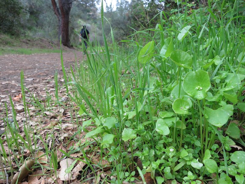
Edible Miner’s Lettuce by the side of Mitchell Canyon Rd.
This part of the trail started shady with a gradual incline, then grew more exposed the higher we climbed. The grade got pretty steep as we ascended past a myriad of wildflowers to Deer Flat, where there were three picnic tables calling our names.
Looking back the way we came from the ascent on Mitchell Canyon Rd.
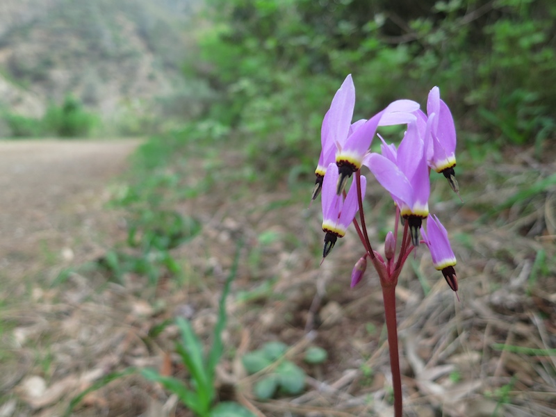
Shooting Stars coming into bloom by the side of the fire road.
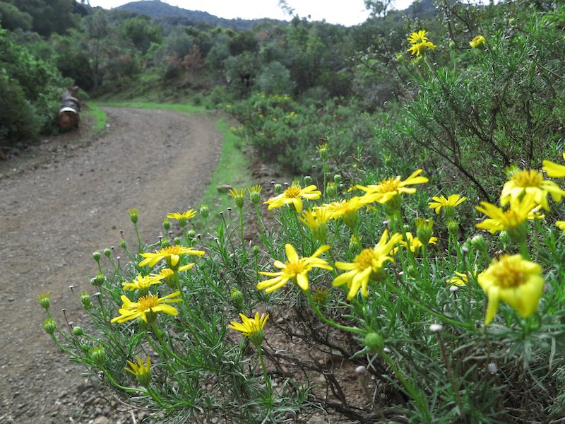
Narrowleaf Goldenbush brightened up the green-on-green spring tones of the chaparral on the climb.
Buckbrush on a north slope along the fire road.
Russell reads the dedications on the picnic tables at Deer Flat.
We snacked on flattened bananas, fig newtons, and old trail mix; before leaving, we added water to our dehydrated beans in peanut-butter jars so they could rehydrate as we walked.
After Deer Flat, the trail wound up and up, then kicked us out on the west side of the ridge, yielding our first views of the bay and Marin County.
Me walking up the red dirt of Mitchell Canyon Rd.
Brilliant marigold-colored wildflower by Deer Flat Rd. Some brassica sp.?
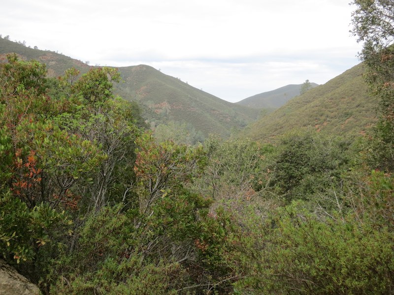
Expansive views from Mitchell Canyon Rd after Deer Flat.
Looking westward towards the Bay and Marin County from the Deer Flat Rd junction.
After the lookout, we headed up Deer Flat Rd, trailing a hiker or trail runner whose legs showed every muscle in stark relief — an aspiration anatomy lesson for hamstrings and quadriceps if I ever saw one. He quickly pulled ahead of us and we never saw him again. Quelle surprise.
Deer Flat Rd trundled up the mountain before dropping us out in the Juniper Campground loop. We walked through the campground, past some functioning port-a-potties which Russell took advantage of, and initially missed the trailhead for Juniper Trail. There is a parking lot for this popular trailhead, and we walked all the way to the end of it, past dayhikers and their SUVs (and Priuses), before doubling back and locating the trailhead off to the left.
Juniper Trail is a nice single-track trail that kicked my butt. I kept my pace slow and steady as we climbed out of the wooded area by the campground, and hiked alongside a charred area from the September 2013 Morgan Fire that burned over 3000 acres in the park.
Blackened remains of chaparral along Juniper Trail.
Juniper Trail appears to have been a fire break on this slope.
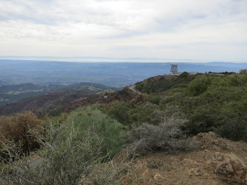
After a short but sweaty climb, the trail took us past a large communication tower and into a vast parking lot. We refilled our water bottles at the Sunset Picnic area drinking fountains; we had to hold the buttons down for a good 5-10 seconds before water came out.
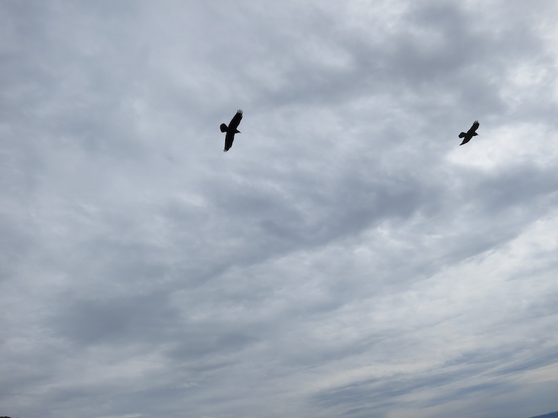
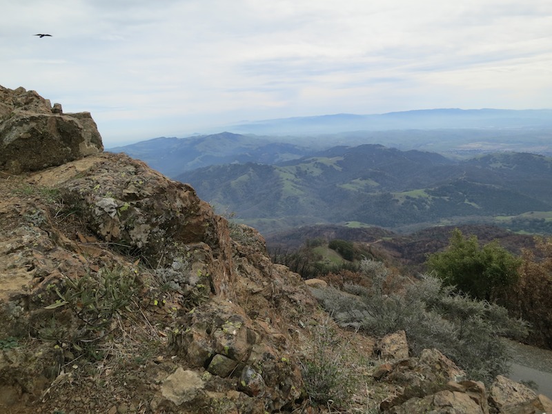
We had now reached the point we drove to in 2012. We took the Summit Trail that winds up between the two one-way roads to the summit, up and over rocky crags that I almost tripped on. Several crows flew up from below and zoomed over our heads — what a treat.
Russell and the incongruous communication tower.
A sea of parking lot to accommodate crowds visiting the summit.
Sunset Picnic Area below the Mount Diablo Summit.
We climbed up above the communication tower quickly on our way up Summit Trail.
Crows above the Summit Trail.
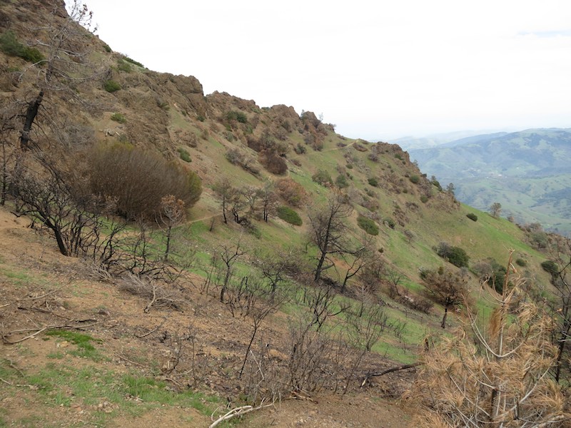
Looking south and west from Summit Trail — more rocks and less forest than Juniper Trail.
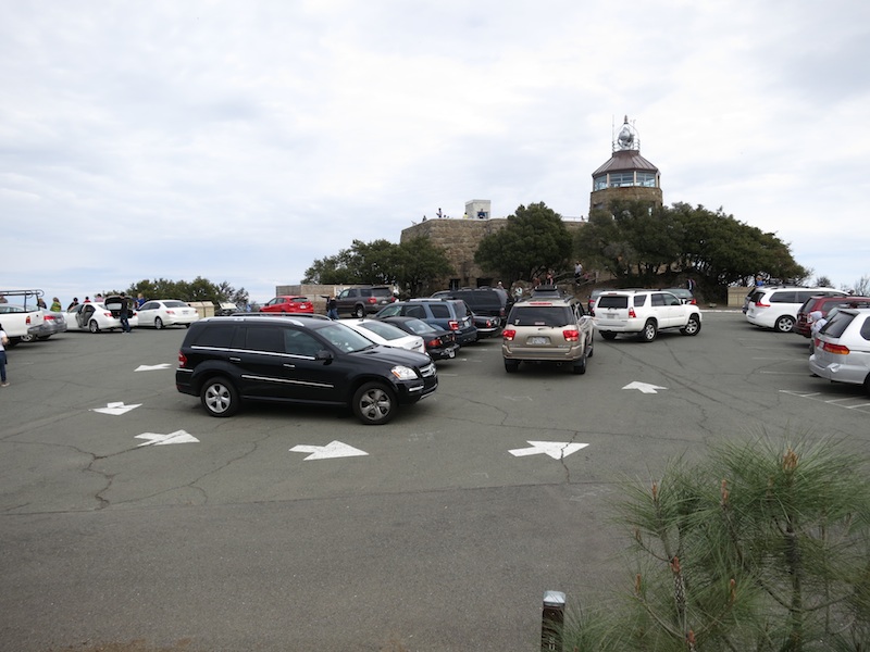
The summit was busy with cyclists and tourists of all stripes. Russell overheard other visitors discussing ice-cream sandwiches, and in a move that should surprise no one, ever, we responded by buying our own and inhaling them before heading up the tower to take in the views from the top.
Follow the painted arrows, herd of big cars. Parking lot at Mount Diablo Summit.
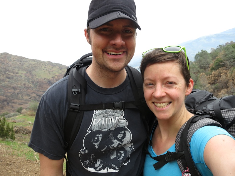
Russell & me at the Mount Diablo Summit, with the North Peak in the background.
Looking north & east from the Mount Diablo Summit.
Eastward (?) view from Mount Diablo Summit.
After descending from the stone tower, we sat down on a little wall near the official summit plaque, and wolfed down our rehydrated split pea soup and curried lentils, topped with Fritos for texture and calories (160 cal/oz — hard to beat!).
I threw on my windshirt as we sat and ate, and snuck a couple Snickers bars into my belt pouches for the hike back.
The ranger inside the Summit Visitor Center was gruff initially when I asked to look at a map to locate the trailhead for the North Peak Trail. He softened up when we mentioned we were heading back to the Mitchell Canyon entrance, and told us how to get down to the trail. Despite his directions, we still walked right past our trailhead, having to double back after ascertaining that the trail we passed was the only one in the right general vicinity.
Pathfinding tip — to get to North Peak Trail from the summit, take the trail right by Sunset Picnic Area that is labeled “to southern edge of park” or “Devil’s Pulpit”. That is an extension of the Summit Trail, and it will pop you out at a small parking area on Summit Road where you can pick up the North Peak Trail.
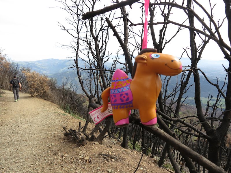
Horse or camel? On the Summit Trail down to North Peak Trail.
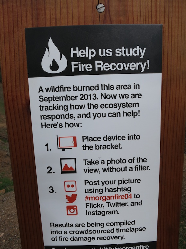
I paused at the North Peak trailhead to snap a shot of the hillside as part of a Morgan Fire recovery documentation project, before continuing down the trail.
The North Peak Trail from the trailhead. #morganfire04
Crowdsourcing images of the Morgan Fire recovery: station 04 at the North Peak Trailhead.
The North Peak Trail heading back north.
Russell & me on the North Peak Trail.
The ranger at the summit had strongly advised against taking the Prospector’s Gap fire road (too exposed and steep), but when we got to an intersection where we expected to see Bald Ridge Trail, all we saw was Prospector’s Gap (and two other fire roads). I wondered out loud where the Bald Ridge trailhead was, and a nearby hiker with a big camera yelled to us that it was a few yards down the Prospector’s Gap road.
Thanks, camera guy! Bet your macro flower shots are way better than mine…
On Bald Ridge, we looked for poison oak, and didn’t see any in leaf, but avoided brushing up against bare twigs to be safe. I have never gotten poison oak before, and don’t wish to, but not enough to wear long pants like Russell. Two days post trip, I have no rashes, so it appears that my shorts gamble paid off.
Risking poison oak by hiking in running shorts. What can I say, I like to live on the edge.
Indian Warrior in bloom with red foliage by the side of the trail.
As we headed down the North Peak Trail, I got a second wind and did a little trail running. It started when I guessed that it would be more comfortable to run than walk down some of the steeper sections of the trail. I’ve always liked downhill more than uphill (hey, I’m close to the ground), but I took inspiration from Russell’s enjoyment of powering up hills, and tried running up a few too. What a rush!
We reached the junction with our intended trail, Back Creek Trail, and I remembered what I could of the map I’d looked at before coming. The previous hiker had suggested going down Back Creek Trail, but then the route on the map appeared to go cross-country over to Eagle Peak Trail. With poison oak around, I didn’t much feel like off-trail in shorts, so voted for taking Eagle Peak Trail instead, as I knew it would get us to the right spot, eventually.
This was also a mini rebellion against playing it safe, for me. Here was an easy, low-risk time to make a spontaneous call and be a little more adventurous.
Good thing I had that second wind, because the climb up to Eagle Peak was a bit of a doozy. Not too hard, but with more scrambling than the summit climb. A pair of young women at the summit took our picture, saving us from Selfie Limbo once again.
A grassy crest along the trail.
Me & Russell with the westward view from Eagle Peak.
After Eagle Peak, the trail continued down the ridge towards the northern edge of the park. By this point, Russell’s plantar fasciitis was flaring up, and we picked up the pace to get off the mountain and home to warm showers.
The views from this part of the trail were of Concord and the housing developments around the northern edge of the park. As we got closer to the foot of the mountain, we could see the Zion Peak base rock quarry. Turkey vultures circled over head.
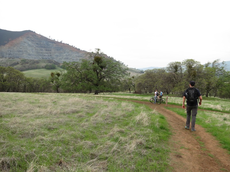
After passing the Twin Peaks and Mitchell Rock, Eagle Peak Trail ran into Coulter Pine fire road Oak Road (Coulter Pine trail is the trail to the right), and we followed that back to the visitor center.
Russell looking down from Eagle Peak Trail towards Concord.
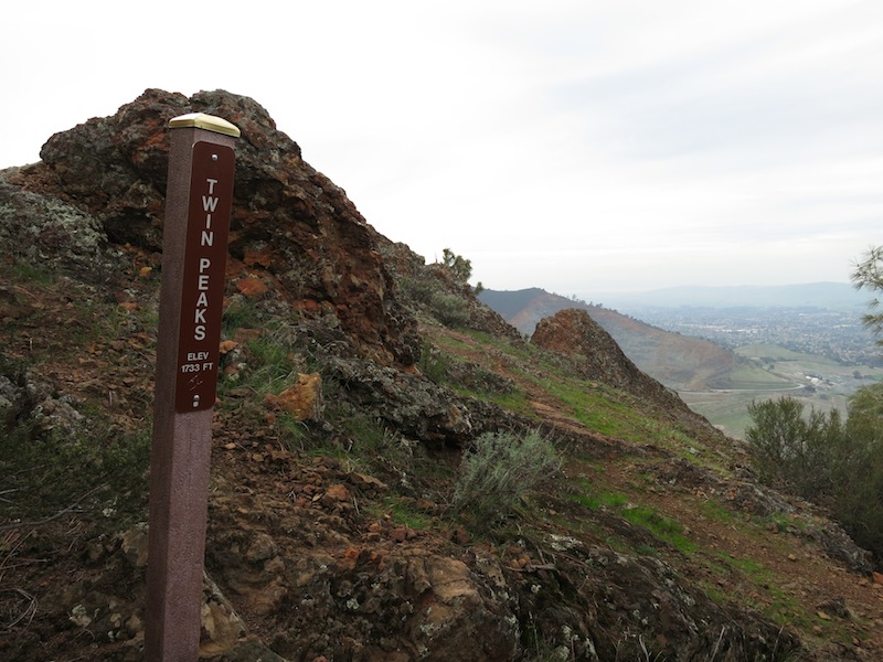
A small promontory called Twin Peaks along Eagle Peak Trail, with Zion Peaks quarry in the background. Insert Kyle MacLachlan joke here.
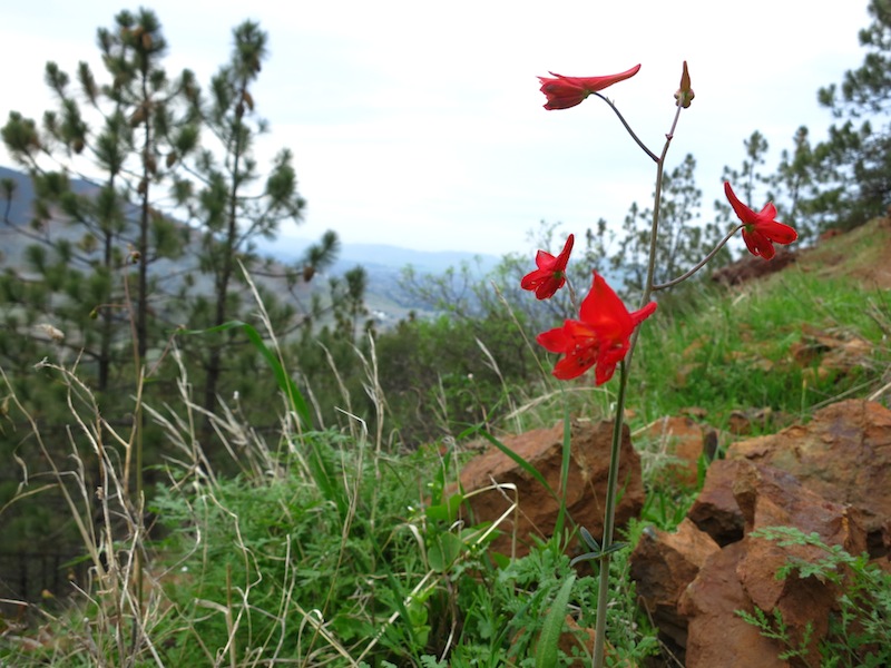
Red Larkspur next to Eagle Peak Trail as we descended.
Russell at the end of Eagle Peak Trail where it joins Oak Road and Coulter Pine trail.
Six hours and forty minutes after starting up Mitchell Canyon fire road, we arrived back at the visitor center, got in our car, and drove home.
Shake it down
So how did this hike match up to my pre-departure goals of fun, training, and shakedown? Great!
Fun
Yup. It was fun. Love being outside, love being outside with Russell. Wasn’t too crowded. Was the perfect time of year to see wildflowers and not wilt in the heat. Clouds and a high of 71º kept me from overheating on the uphills.
Win-win all around.
Training
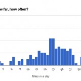
I used my run-tracking web app, MapMyRun, to chart our hike once we were home, and came up with the following stats: 13.2 miles with a total ascent of 3323 ft.This is a comparable distance and elevation change to the latter days up and over a pass on the JMT, so the hike met my goal of being decent training for the PCT.
I want to do some longer mileage hikes before my start date, to get my body used to moving for more than 7 hours over the course of a day. For high intensity, though, this hike did just fine.
Gear shakedown
My new pack did great on this hike. I didn’t weigh the pack before leaving, but I’d estimate it around 12 lbs with 4 lbs of water, 1 of food, and 7 lbs of gear that I scrounged up. I’ll be carrying more weight for many parts of the trail, so next I will test it at 20 lbs and 30 lbs (boo, heavy water carries). My biggest question about the Burn was how it was going to feel on my shoulders with at least some load — and it felt good.
At some point I realized that I hadn’t cinched the waist belt enough to transfer load to it, and that I’d been carrying on my shoulders alone. I cinched it harder (hang in there, winter belly!) and could then get fingers under the shoulder straps easily.
Sporting my MLD Burn pack on the stairway up to the Mount Diablo Summit.
The only bummer was that I couldn’t reach the water bottles in the side pockets. I could get them back in with intense contortions, but not out. Stay tuned for a first look review of the MLD Burn pack coming up.
The clothing performed great on the hike, as evidenced by the fact that I didn’t think about it at all until the trip home, when I realized I hadn’t thought about it… A good outcome in my book.
A few times my toes felt jammed up against the front of my shoes on descents, so I will adjust my shoe lacing again to see if I can get rid of that. Maybe tighter around the midfoot? Suggestions are welcome. I didn’t get any blisters, though, which was great.
Happy hiking
Overall, this was a fantastic hike. It was strenuous — those climbs up the fire roads and Juniper Trail are no joke — and I would try harder to leave earlier in the morning next time. It’s highly worth it though — all that work earns some of the most spectacular views in the area (even more so when the sky is clearer).
I think this is the perfect time of year to be out in the East Bay hills. The rain has perked up all the spring growth, and there aren’t crazy crowds of visitors yet.
Rating: A+ (Go, do it now!)
Love the new haircut!! It will make your life soo much easier.
I’m in the process of growing mine back out… not as fun!
Thanks. I’m definitely digging the short hair this time around. It is SO EASY to take care of. Worth it for the trail for that reason alone.
Thanks for this report! What an amazing landscape!
The wildlife shots are great. No turkeys in the turkey trap, I see.
The hot sunny day and 1+ gallon water combo is a good one to go for.
I will now copy and paste Wikipedia’s answers to two burning questions I had about this amazing location.
Mount Diablo is sacred to many California Native American peoples; according to Miwok mythology and Ohlone mythology, it was the point of creation. Prior to European entry, the creation narrative varied among surrounding local groups. In one surviving narrative fragment, Mount Diablo and Reed’s Peak (Mount Tamalpais) were surrounded by water; from these two islands the creator Coyote and his assistant Eagle-man made Indian people and the world. In another, Molok the Condor brought forth his grandson Wek-Wek the Falcon Hero, from within the mountain.
The conventional view is that the peak derives its name from the 1805 escape of several Chupcan Native Americans from the Spanish in a nearby willow thicket. The natives seemed to disappear, and the Spanish soldiers thus gave the area the name “Monte del Diablo”, meaning “thicket of the devil.” Monte was later misinterpreted by English speakers as mount or mountain.
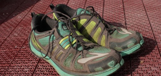
I’m enjoying your blog. I just read your JMT ’13 trip and am looking forward to following your PCT trip. About your shoes…my only comment would be lacing tighter at the collar of the shoe and put in a surgeon’s knot in your starting knot. That is, when you first loop your laces before tying the knot, make two loops instead of one and make sure this knot is laying tightly atop the tongue to keep your heel locked into the rear cup and preventing your foot from sliding forward inside the shoe when on descents. It may feel overly tight to start with but it saves your toes.
Thank you for a very informative post.
By the way, I believe that trap is for wild pigs, not turkeys.
Thanks for the correction — I’ve updated the post.
Thanks for this post. This is the best trail information to the summit I have found online.
I am planning to hike Mt. Diablo around the end of August/early September. When you say there are strenuous parts, how bad is it? My daughter and I frequently home Black Diamond Mines, that is what we know, how much worse is Mt. Diablo? I know it is longer and higher, I mean the incline levels I guess.
Hi Genoa, I hope you had a lovely hike last year. I’m not familiar with Black Diamond Mines, but I would say a challenging part of the Mt. Diablo hike in August or September could be the heat, and managing your hydration. Take more water than you would expect, and you can fill up at the drinking fountains near the summit.
Excellent write-up and description! Here are a couple of edits for you (I am a volunteer docent with Mt. Diablo Interpretive Association): 1) the name of the last trail you took after Mitchell Rock Trail is Oak Road – the fire road that leads back to the trailhead and parking lot at Mitchell Canyon. After descending Mitchell Rock Trail, the narrow trail to the right is Coulter Pine Trail, and the fire road to the left (and also to the slight right) is Oak Road. To reach the parking lot from Mitchell Rock Trail, turn left on Oak Rd. 2) The trap in the excellent photograph is a pig trap. The wild (non-native) pig population on Mt. Diablo is growing rapidly. Wild pigs are destructive to the landscape and although they are nocturnal and seldom seen by humans, they can be dangerous if encountered.
Thanks for the corrections and info, Joyce! Mt. Diablo such a wonderful site — thanks for helping us understand it better.
Hi Alice, loooove your blog. Your detailed descriptions are SO helpful. I hiked up to Diablo summit from Mitchell Canyon in the spring of 2013, and then again this past Tuesday. I do the hike to train for Half Dome (which I’m doing this coming Monday). I couldn’t find a good description of the loop from Mitchell Canyon and back down, but your post led me all the way! In 2013 I missed the turn for Eagle Peak and ended coming back down via Meridian. This time I went through Eagle Peak thanks to you. =D
I also LOVE your posts on the PCT, as I’m planning to thru-hike next year. So much useful info, especially the gear weights and comments on what worked and what didn’t. Thank you again.
Thanks so much, Jessica. I’m so glad the description of the Mt. Diablo hike was helpful — that’s why I write.
Have fun preparing for the PCT! Feel free to hit me up if you have any questions between now and departure. You’re gonna have an amazing hike
Hi! Thanks for this write-up! I just came across it when I Googled Mt. Diablo summit hike. It was an awesome day! I’m definitely going to check out the rest of your blog!
Just a couple of things. I’m not sure if I took some wrong turns or if the signs have changed. Wrong turns are completely possible because my fitness app says my hike was over 23 miles…..I’ll post what I can remember…my notes didn’t save…but maybe this, or the response to it will help someone else…
First, Deer Flat didn’t seem to be a road, but an area. I read the info posted about wildlife and looked around for a trail head but didn’t see one. After passing thru Deer Flat I came to a fork: left (straight) one took me down XX Canyon Rd. (can’t remember the name) and the right one was Juniper Campground Rd. I passed another hiker on his way down and he said I was on the right path (a right path, but probably not “the” right path anyway!)
Second, at the top of Juniper Campground Rd. you have to go left or right. There was a marker pointing left, but it did not say Juniper Campground (surprise, I don’t remember what it said) but another hiker directed me that way. The marker did not say what was to the right.
Third, on the way back down, I found a trail head marked south gate or south something, but couldn’t find anything that said, “to southern edge of park” or “Devil’s Pulpit.” I’m wondering if this would have been the right option, but it was 430pm and sundown was 730pm, so I decided to high-tail it back the way I came….I ran most of the way down. Yikes- I’m going to hurt tomorrow!
Thanks again!
PS- my time was 6h 5m, so maybe my fitness app just double counted when I was running down those steep hills. I haven’t noticed before, but I guess that is an possibility.
Thanks for the great review of this hike! I solo hiked this yesterday. I have to say coming down on Bald Ridge and Eagle Peak kicked my butt! I am impressed that you ran down sections of these, that rocks! Needless to say my time was closer to 9 hours cuz I was so slow coming down 😛 (Like Russell, I loved powering up the grades though). I felt some of the trail markers around the Juniper and Summit areas left something to be desired. Like you, I overshot and backtracked a lot. There was a lot of guesswork involved. North Peak trail wasn’t even marked at all! Just said “general trail” (or something like that). Nice that there was a huge topo map right next to the trailhead, though. Everything after Bald ridge was marked pretty well, I thought. The views were amazing. I went on a very clear, smog-free day and I was dazzled. Water-wise, I took a three litre bladder with me and didn’t top it off enroute. Ran out about two miles away from Mitchell Canyon Rd. My bad, next time I will pack an extra gatorade, too.
Just did this same hike a few days ago except that my cousin and I got lost 7 times, haha. Oh yeah, and it was in the lower 90’s…. Definitely a good and fun hike, thanks for posting this, it gave me the motivation to finally get up and do it, haha!
Hello Alice. I was looking for md trailhead when I ran into your experience. Thanks for the post. It’s very informative. I’ll do this tomorrow, cause I’m preparing for pct. where can I find your jmt and pct hikes notes? I’m taking classes at REI and sportsbasement. Meantime, l am looking for a thru hike company or companies.
Hi Alice
Great write up. My son and I did it this weekend, using your guide as a basis! The blog is here: http://candiegohiker.blogspot.com/2016/08/mount-diablo-base-to-summit.html
Alice,
Thanks for the blog post, and all the wonderful photos, it inspired me to try the same hike. I got to the Michell Canyon parking lot Friday morning, and to my surprise there was a young woman, Kim, there who had also read the same blog, and was also going to try the same hike. We walked together for the first few miles.
I did great up to the top, and down around the North Peak trail, but unfortunately missed the Eagle Ridge trail — re-reading your blog I see that it was hard for you to find as well! I ended up going up the North Peak Road to the top, down the other side, up the Olympic Peak trail (not real happy about that!) then down an un-named trial, finally to the Donner Creek Fire Road, then some un-named roads out back to the Mitchell Canyon parking lot — 19 miles instead of 13.
The most scary part of the trip was just how few people were on the trail — for the first 12 miles there were six other people on the trail, and for the last seven nobody else.
I’d strongly recommend that people bring a detailed map before they start the hike, and also to go on weekends instead of weekdays when there are other people around you can ask questions when you need to know!
All in all, though, it was an exciting, invigorating experience. Thank you for suggesting the hike, it was inspiring!
Thanks for this detailed writeup! As a fellow Oaklander I’m also looking to Mt Diablo to train me up for a bigger hike in the near future (4-day tramp in New Zealand on Kepler trek)!
Just did this hike, fantastic advice, loved it! Thank you so much.